

Summit County Lake Loop
 As the summer winds down, I find myself trying to squeeze in all of the things I have not yet completed. One of my favorite things in the whole world is mountain biking in Summit County, Colorado. As a former resident, I was spoiled by the fantastic riding and the beautiful surroundings. While I don't miss the long winters at 9,500' above sea level, I do miss the riding.
 When my friend Mark posted a Summit County ride invitation on the Colorado front range forum at MTBR.com a couple of weeks ago, I started planning. Yesterday was the day and we ended up with just the two of us, and another rider from Denver that we met through the forums at MTBR. I met Mark this way, and have met many other great riders whom I consider friends through MTBR.com.
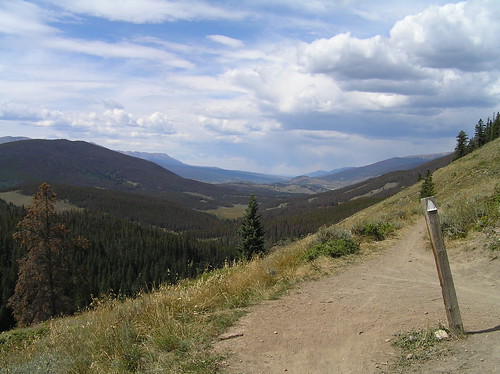
An early start from Fort Collins had us to the meeting point at the Gold Hill trail head a little after 9:00, and we were rolling by 9:30. Because of timber removal due to the pine beetle infestation, the climb up the Gold Hill trail looked a lot different than the last time I rode it several years ago. It was still a grunt, but warmed the legs nicely.
The ride down the back side to the Peaks trail was fast and flowy as always, dropping us into Frisco at 7th Street, after a quick run past Rainbow Lake. For the 2+ years Michele and I lived in Frisco, the area around Rainbow Lake, Miner's Creek, and the lower end of the Peaks trail was our after work playground, so this brought back memories.
A straight shot through town on Hwy 9 and a short ride down the Dillon Dam Road were more pavement than we wanted, but we needed it to connect with the power line trail and the Old Dillon Reservoir trail. It was sad to see that they are draining the lake up top, but I understand there are safety concerns about the earthen dam. A short break on the descent, compliments of my flat rear tire, gave us a chance to take in the scenery before heading across the dam into Dillon.
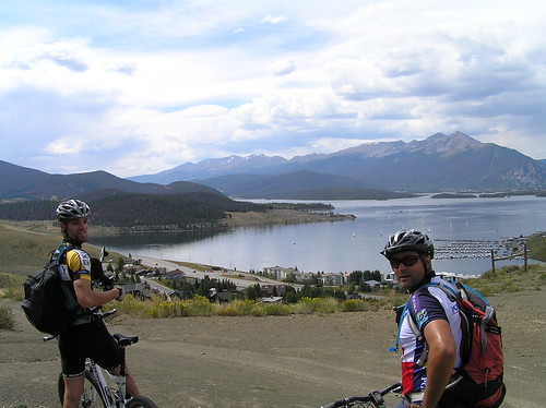
A short climb on pavement through Dillon and across Hwy6, and we were on the Oro Grande Ditch trail that skirts the foot of tenderfoot Mountain between Dillon and Keystone. This is where I usually took my Tuesday night rides when I had my shop in Dillon. Not too difficult and great views are a good combination when leading group rides. We followed this all the way past the shooting range and up Frey Gulch to the Conference Center trail before dropping into Keystone.
A short climb on pavement through Dillon and across Hwy6, and we were on the Oro Grande Ditch trail that skirts the foot of tenderfoot Mountain between Dillon and Keystone. This is where I usually took my Tuesday night rides when I had my shop in Dillon. Not too difficult and great views are a good combination when leading group rides. We followed this all the way past the shooting range and up Frey Gulch to the Conference Center trail before dropping into Keystone.
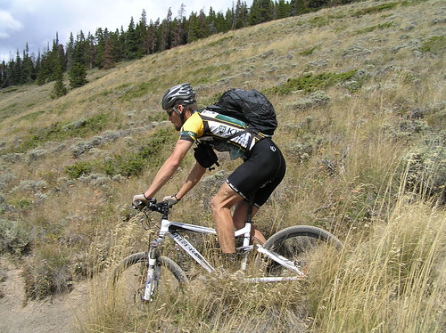
A quick ride through the lakeside village and we were at the bottom of Keystone Gulch. The next 6 or 7 miles consisted of a long uphill grind. Because I had not been drinking or fueling sufficiently this day, and apparently not riding enough since the Laramie Enduro, I began to bonk about 3/4 of the way up this climb. As I neared the top, my left thigh was cramping enough that I had to walk some sections. I ate Clif Bloks, a PB&J sandwich, and Hammer Gel, and a mini Bagel, but it was a little too late. I probably should have eaten some of the jerky I had to get some salt into the system, but had forgotten it was in my pack.
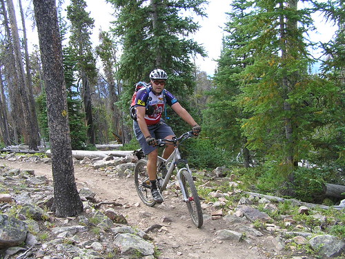
A bit more walking brought me to my favorite piece of single track in the state of Colorado, the Colorado Trail atop West Ridge. My riding partners were waiting for me, and after a short break, we set off. Despite being worn out, I enjoyed this as much as always. There is an element of fear as you travel a smooth single track at nearly 30 miles an hour with a precipitous drop off less than a foot to your side, but the mountain continues to pull you faster and faster.
This was the second time riding this section on my Moots YBB SL, and the first time with the Fox RL100 on it. I was also running stiffer wheels this time, and I think the combination of the stiffer wheels and longer travel, stiffer fork made me feel more stable and made the ride more fun.
At the Horseshoe Gulch crossing, I decided my legs were not going to handle the final climb, so I urged Mark and Brian to continue, while I exited the Colorado Trail here, via the Dredge Boat trail head, and rode down Tiger Road to the car. The paved ride should have been easy, but I pushed a head wind all the way back to the car, arriving only 15 minutes before the others.
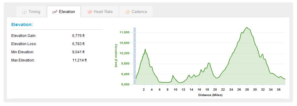
According to my Garmin Forerunner 305, our stats showed nearly 38 miles, nearly 3,100 calories burned, over 6700 feet in elevation climbed, and all over 9,000 feet above sea level. 
posted by sgltrak | 4:41 PM
![]()
0 Comments:
Post a Comment
<< Home